Service
ECDIS Simulator
We develop simulator systems that allow users to learn ECDIS operation by recreating the same navigation environment as at sea. Japan Marine Science’s ECDIS simulators are used in merchant marine and fisheries educational institutions and corporate training centers both in Japan and overseas.
Overview of the ECDIS Simulator
This simulator system enables both the generic training required by the STCW*1 Convention and type-specific training for proficiency in the operation of each ECDIS manufacturer’s equipment.
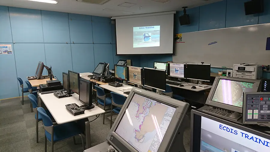
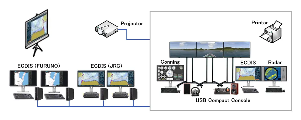
The product generates real-time navigation signals from the own ship and surrounding target ships in the simulated area. Various training scenarios can be created according to needs. The system consists of an instructor station and multiple trainee stations, providing an efficient training environment. Leveraging know-how from our ship handling simulators, we can also reproduce a realistic navigation environment linking precise ship motion models and 3D visuals. ECDIS simulators can be tailor-made according to budget and purpose.
We also provide total support, from curriculum development to procedures required for issuing various certificates of completion. Please consult us for more details.
※1 International Convention on Standards of Training, Certification and Watchkeeping for Seafarers
※2 Compatible ECDIS units are as follows:
JRC (901B/JAN-9201)
Furuno (FEA2801/FMD3X00 series)
※3 Consists of an instructor station and trainee stations, with pre-installed training sea area data for five regions: Tokyo Bay, Ise Bay, Osaka Bay, Kanmon Straits, and Singapore Straits, along with corresponding traffic data for each sea area.
System Features
The following features are included, allowing for authentic ECDIS operation training:
- Own ship model (response model), target ship model (WayPoint model*1)
- Steering and engine telegraph operation
- Own ship maneuvering modes (HAND/AUTO/TCS*2)
- Creation of target ship’s traffic data
- Error value settings (GPS, GYRO, LOG)
- Simulated failures (GPS, LOG, GYRO, AIS)
- Sending NAVTEX messages (user-defined text input)
- Generation of various simulated signals (GPS, LOG, GYRO, AIS, NAVTEX, TCS), radar echo, etc.
※1 A model independently developed by Japan Marine Science that navigates along a pre-set speed and route.
※2 The Track Control System is a system that navigates the vessel according to the planned route set on the ECDIS.